What the October El Niño outlook actually predicts
The U.S. winter outlook for 2026–27 is coming into focus, and California's winter flood risk is drawing renewed attention as El Niño strengthens in the Pacific. An October 31 USA TODAY report examines whether the coming season could produce an ARkStorm-like disaster. The essential distinction is that ARkStorm describes a scientifically constructed extreme-storm scenario, not a named storm approaching California or a prediction that a megaflood will occur this winter. The evidence supports preparation for serious hazards while leaving the timing, location and scale of individual storms unresolved.
NOAA's national winter outlook, released October 15, covers December 2026 through February 2027. It favors warmer-than-average conditions across the northern United States and wetter-than-average conditions across the southern tier and East Coast. The agency expects drought improvement in much of the Southwest, Southern Great Plains and East, while parts of the northern Rockies could see drought develop or worsen. These are probabilities for seasonal averages and totals, rather than a forecast for a holiday weekend. Areas with equal chances of above-, near- or below-average conditions should not be read as having a guarantee of normal weather. NOAA lists November 19 as the next winter-outlook update.
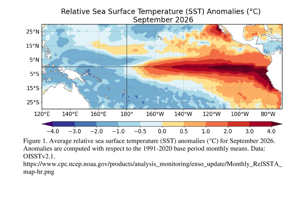
The Climate Prediction Center's October 8, 2026 diagnostic discussion maintains an El Niño Advisory. It describes a coupled ocean-atmosphere system that strengthened during September, with a strong-to-very-strong event likely through January–March 2027. Its probability of more than 83% concerns that seasonal El Niño strength. It is not an 83% probability that California will experience catastrophic flooding. A percentage needs its original event and time window attached to it to retain its meaning.
The geographical differences matter just as much. The U.S. Geological Survey's Southwest assessment explains that a more southerly Pacific jet stream can bring additional storms to southern parts of the country during El Niño winters. Southern and Central California often receive more precipitation, but the agency cautions that this relationship does not hold every time. In Northern California, El Niño alone offers much less help in determining whether winter will be wet, dry or near normal.
Atmospheric rivers complicate the seasonal picture. These narrow corridors transport moisture, and their number, landfall location and angle influence where precipitation falls. USGS cautions that El Niño is not a strong predictor of these events across the Southwest. A broad Pacific signal therefore cannot identify which watershed will receive repeated heavy rain or which coastal road will flood on a particular date. Those are questions for more immediate weather and water-level information.
The California Geological Survey also warns against treating El Niño as a universal landslide switch. Rain can saturate rock and soil in any ENSO phase, including La Niña and neutral conditions. Historical outcomes differ even among strong El Niño years. That record is a reason to examine local slopes, drainage and forecasts rather than assume that a familiar climate label will produce the same conditions statewide. The current outlook changes the context for winter planning; it does not eliminate local uncertainty.
A wetter winter can also replenish water supplies and support ecosystems, the USGS assessment explains. Snow outcomes depend on temperature as well as precipitation: a seasonal expectation of wetter conditions does not, by itself, establish how much snow will accumulate. For water managers, both the cumulative seasonal supply and the timing of individual storms matter.
Sources: NOAA — October 15 U.S. winter outlook ↗ · NOAA CPC — October 8 ENSO discussion ↗ · USGS — Southwest El Niño impacts and limits ↗ · California Geological Survey — El Niño and landslides ↗ · USA TODAY via AOL — October 31 ARkStorm reporting ↗
ARkStorm is a planning scenario, not an incoming storm
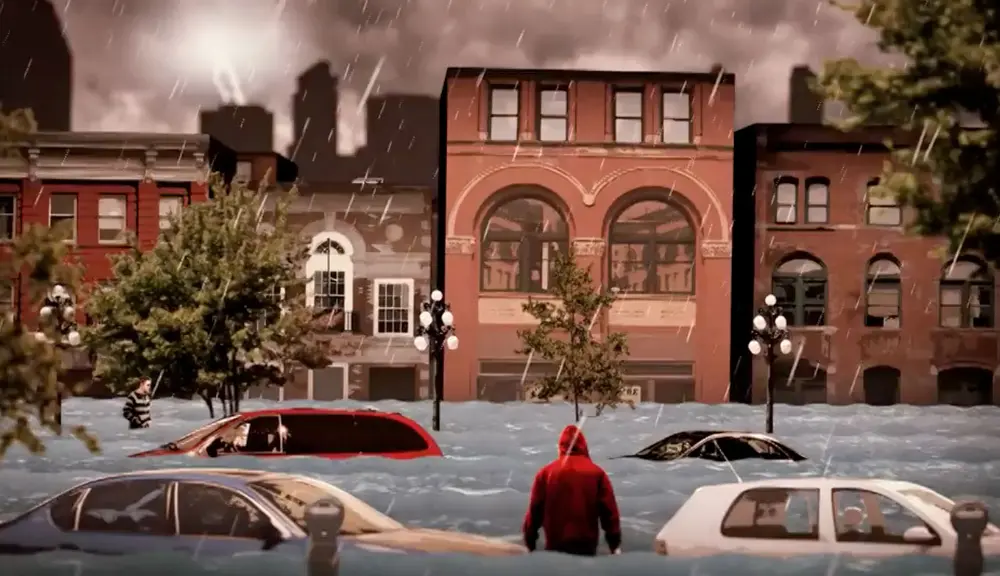
ARkStorm was developed to test what a severe sequence of West Coast winter storms could do to modern California. The USGS project takes historical events, especially the devastating winter of 1861–62, as a starting point and uses modeling to explore a plausible modern disaster. Its published overview dates to January 14, 2011. The age of that report is important: a scenario newly discussed in a headline is not necessarily a newly issued weather forecast.
The exercise examines consequences beyond water covering a street. Flooding can interrupt electricity, water and sewer services, damage transport routes and disrupt businesses far from an individual overflow. In the scenario, prolonged precipitation produces secondary hazards such as landslides and coastal inundation. The point of combining these effects is to help emergency planners and infrastructure operators consider a disaster that crosses administrative boundaries, rather than plan only around a single neighborhood or damaged facility.
USGS describes the scenario as scientifically plausible and informed by historical and geological evidence. That establishes that extreme flooding deserves serious attention. It does not supply a calendar date for the next comparable event. The original report estimated approximately $400 billion in property repair costs and another $325 billion in business interruption under its scenario. Those are historical modeling results, not damage already sustained in 2026 or an updated estimate of this winter’s losses. Their value is in revealing interconnected vulnerabilities, with the assumptions and age of the exercise kept explicit.
The October 31 USA TODAY coverage returns to the question through interviews with atmospheric-river and climate specialists. Their concern centers on the possibility of repeated heavy precipitation over an extended period. That is a more specific mechanism than simply saying that a strong El Niño causes a flood. How storms line up, where they make landfall and how long the sequence lasts remain central to the outcome. Concern about those possibilities is different from certainty that they will occur.
The useful way to read an ARkStorm reference is to ask what role it is serving. A scenario can expose weaknesses in emergency communications, transport access or utility recovery. A seasonal outlook can change the odds of broad climate conditions. A short-term forecast can help identify an approaching hazard. Treating those products as interchangeable would make the most dramatic scenario sound like a current warning, while obscuring the information residents actually need to make decisions.
Sources: USA TODAY via AOL — October 31 ARkStorm reporting ↗ · USGS — ARkStorm scenario project ↗ · USGS — original January 14, 2011 scenario report ↗
What California is preparing for—and what residents should check
Preparation is already visible in official actions, without assuming that the worst scenario will happen. San Francisco announced a local emergency on October 23 to accelerate its El Niño preparations. The city's explanation says the declaration relaxes certain contracting requirements, strengthens coordination through an incident-command structure and supports the acquisition of supplies. It is an administrative step to improve readiness for winter hazards, rather than an announcement that an ARkStorm has begun.
The city identifies several possible disruptions: heavy rain and wind can affect streets, trees and power, while elevated coastal water levels can cause high-tide flooding even without rainfall. That distinction matters for residents who associate flooding only with a downpour overhead. Coastal water levels and inland runoff do not represent identical hazards, and a dry period at one location does not by itself resolve the risk along a nearby shoreline.
State preparations described by Governor Gavin Newsom's office on October 9 include staging flood-fighting supplies, checking water infrastructure and improving disaster coordination. The announcement also describes rescue equipment for 13 local fire departments and expanded access to satellite information for disaster assessment. These are documented readiness measures. They do not establish that every community has equal protection or that supplies will prevent all storm damage.
For coastal property owners, the California Coastal Commission recommends checking drainage, identifying areas vulnerable to waves or erosion, and addressing potential sources of damage before storms arrive. Its guidance notes that some work may require permits and directs owners with questions to Commission staff. Practical preparation should follow the requirements for the actual property and location; a general article cannot determine what construction or shoreline work is appropriate for a particular site.
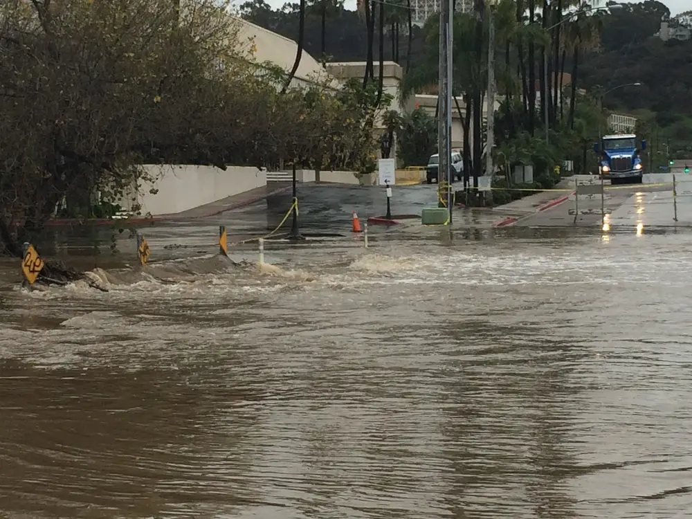
The Commission also directs people to local officials and National Weather Service advisories, watches and warnings. Those products should be checked for their issue time, affected area and duration. An archival photograph of a flooded California road can illustrate a real past consequence, but it cannot establish that the same road is closed today. Similarly, the September ocean-temperature map accompanying the October ENSO discussion records a climate observation, not a street-level flood forecast.
The coming winter contains genuine uncertainty, and that is compatible with taking concrete steps now. The scientific record supports attention to atmospheric rivers, coastal conditions and local vulnerability. Government announcements show preparations underway. What the record does not establish is that a specific statewide megaflood is scheduled for this season. The next useful developments are updated climate assessments, approaching-storm forecasts and local instructions that turn broad risk into information about a particular place and time.
Sources: SFPUC — October 23 preparedness emergency declaration ↗ · Governor of California — October 9 winter preparations ↗ · California Coastal Commission — property preparation guidance ↗ · USGS — historic San Diego photograph and rights ↗
Why this story is in the editionThe Google Trends U.S. RSS feed reviewed October 31 included “el niño” and linked to current California flood-risk coverage. This supports discovery only; no search rank or search volume is claimed. The existing winter-outlook article was expanded to avoid duplication.
Prepared with AI assistance. Source-based reporting checked on 2026-10-31. This article does not update automatically. Read our editorial standards.