Minnesota tornado watch on October 28: the verified area and time
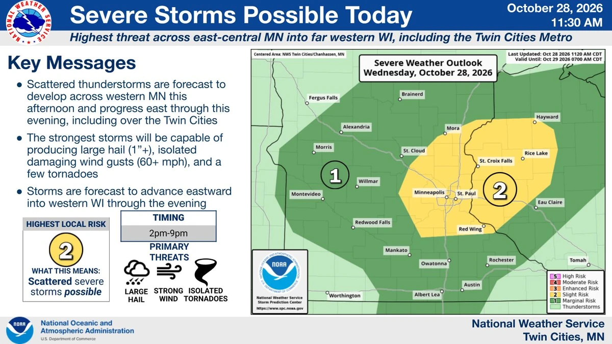
A tornado watch issued at 3:40 p.m. Central Daylight Time on October 28, 2026, covers parts of Minnesota, including Hennepin and Ramsey counties. The National Weather Service’s published outline gives Watch 698 an expiration of 9 p.m. CDT that evening. A watch means conditions support possible tornadoes; it does not establish that a tornado has touched down. Check the linked NWS Twin Cities page for current warnings, cancellations and changes before making decisions.
The outline lists Anoka, Benton, Carver, Chisago, Dakota, Goodhue, Hennepin, Isanti, Kanabec, Le Sueur, McLeod, Mille Lacs, Nicollet, Pine, Ramsey, Rice, Scott, Sherburne, Sibley, Washington and Wright counties. This is the area in the issued watch document. A later cancellation or warning may cover a different area, so the list should not be read as a permanent alert for every location until the clock reaches nine.
The 2:36 p.m. NWS Twin Cities hazardous-weather outlook forecast scattered thunderstorms through early evening, with large hail, damaging winds and a couple of tornadoes possible. The forecast describes potential hazards, not verified damage. This report does not claim confirmed tornadoes, injuries or property losses from the watch itself. Those would require separate observations or official reports.
FOX 9’s local forecast independently described a conditional severe-weather threat. Its meteorologists identified a main window from 2 p.m. to 9 p.m., with the stronger Twin Cities risk concentrated between 4 p.m. and 8 p.m. Conditions favorable for storms were present, but the severe outcome depended on how ingredients came together. The local forecast and the official watch therefore support preparation without establishing that every community would experience the same storm.
The Storm Prediction Center’s overnight outlook explained the uncertainty more specifically: strong wind shear could support organized storms, while limited instability could constrain development. Additional warmth or moisture could make the environment more favorable. That earlier discussion provides background to the afternoon threat; it is not a substitute for a later warning about a particular storm.
“Tornado watch” and related Minnesota queries appeared in Google Trends’ United States view checked on October 28. Their presence supports the timeliness of the reader question, without establishing a national search ranking. For someone in the affected area, the useful information is the exact alert type, its geographic scope and its timestamp. A widely shared headline cannot replace those details.
Sources: NWS — Watch 698 outline issued 3:40 p.m. CDT October 28 ↗ · NWS Twin Cities — current hazards and updates ↗ · NWS — October 28 hazardous-weather outlook ↗ · FOX 9 — independent October 28 local forecast ↗ · SPC — October 28 overnight convective outlook ↗ · Google Trends — U.S. view checked October 28 ↗
Watch versus warning: when preparation becomes immediate action
The National Weather Service distinguishes between a broad watch and a more localized warning. The Storm Prediction Center issues watches for places where tornadoes may occur. A local forecast office issues a tornado warning when a tornado has been sighted or indicated by radar. That warning calls for immediate protective action. A person should not wait for a photograph or a separate social-media confirmation before responding to an official warning affecting their location.
The warning area is usually much smaller than the watch area. This is why a county appearing in a watch list and an address falling within a warning are different pieces of information. Read the locations and instructions in the alert itself. The safety meaning comes from what the alert says and where it applies, rather than from assuming that all warnings within a large weather system are interchangeable.
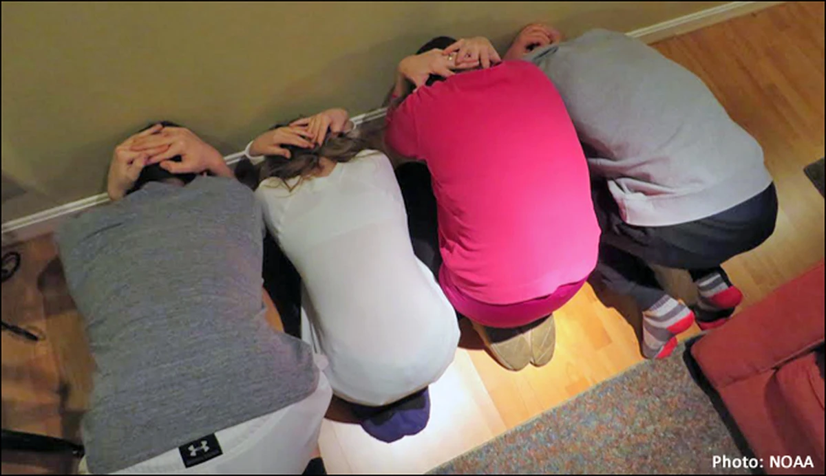
For a tornado warning at home, NWS guidance directs people to a basement, safe room or interior room away from windows. In a workplace or school, follow the established tornado drill and proceed to the designated shelter. Avoid large open rooms such as gymnasiums, cafeterias and auditoriums. People outside should seek a sturdy building; a tent, shed or mobile home does not provide the same protection.
The CDC advises identifying a nearby building in advance if you live in a mobile home. Its preparation guidance also recommends discussing shelter locations with children and identifying someone who can help a person with functional needs. Keep a written list of important needs and medications accessible. Planning the route and the assistance beforehand reduces the number of decisions left for the moment an alert arrives.
Tornadoes are not confined to a particular hour or season. NWS describes them as rotating columns of air extending from a thunderstorm to the ground and notes that they can occur at any time of day or year. That does not establish how likely one is at a particular Minnesota address tonight. It explains why the date on the calendar alone is not a reason to dismiss the official alert.
The practical distinction is therefore between being ready to move and being instructed to move now. Preparation can happen during a watch. A warning, or an approaching tornado, requires immediate shelter. Neither the watch’s scheduled expiration nor a general forecast window should be treated as permission to ignore a more specific warning.
Sources: NWS — understanding tornado alerts ↗ · NWS — what to do during a tornado ↗ · CDC — preparing for a tornado ↗ · NWS — tornado background and safety ↗
Receiving alerts and preparing a household before storms arrive
NWS preparedness guidance recommends checking forecasts regularly, learning how your community sends warnings and agreeing on a family communication plan. Identify an interior shelter location on the lowest floor, away from windows, and make sure household members know where to go. If your building lacks an appropriate shelter, identify a safer nearby building before conditions deteriorate. Pets belong in that planning too, when time allows.
Practice matters because the plan needs to work for everyone present, not only for the person following the forecast. A household may have children, visitors or someone who needs help moving. Discuss the meeting place and how to communicate if separated. NWS also encourages checking supplies and practicing the response. Those are preparation steps to take while there is time; they are not reasons to delay shelter when a warning is issued.
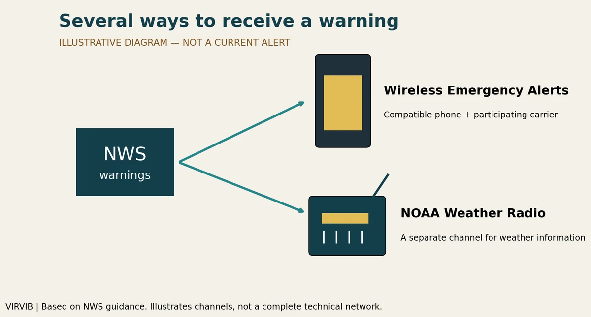
Wireless Emergency Alerts provide another route for urgent information. NWS explains that authorized government agencies send them through participating mobile carriers to compatible phones. No separate app download or signup is needed for that system. A message typically identifies the alert type, timing, recommended action and issuing agency. Device capability and carrier participation matter, so a phone should not be assumed to have every alert feature.
NWS advises following the instructions in the message and seeking additional detail through trusted sources such as local broadcasting or NOAA Weather Radio. Wireless alerts complement other warning services rather than replacing all of them. Some devices may receive alerts near the warning area because of how broadcasts and geographic targeting work. Read the message carefully and check the official local information instead of inferring the exact boundary from the fact that a phone sounded.
The CDC recommends a weather radio with battery backup and a tone-alert feature, so loss of household power does not remove that source of warnings. Its guidance also identifies quickly developing tornadoes as a reason to remain attentive to changing conditions. This is a case for more than one information channel, especially when a household includes people who receive warnings in different ways.
This article records the October 28 watch and explains official safety guidance; it is not an automatically updating warning feed. The linked NWS pages take priority for later changes. The issued watch was scheduled through 9 p.m. CDT on October 28, equivalent to 02:00 UTC on October 29. That cross-midnight conversion describes one endpoint, not two separate watches. Use local alert instructions throughout the evening and check for any updated issuance rather than relying on an old screenshot.
Sources: NWS — Watch 698 outline issued 3:40 p.m. CDT October 28 ↗ · NWS Twin Cities — current hazards and updates ↗ · CDC — preparing for a tornado ↗ · NWS — preparation guidance ↗ · NWS — Wireless Emergency Alerts explained ↗
Prepared with AI assistance. Source-based reporting checked on 2026-10-28. This article does not update automatically. Read our editorial standards.